Parmenter Fire
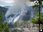
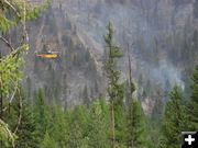
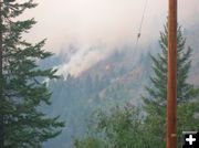
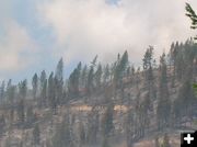
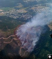
View of fire on Saturday, July 26, 2008. Kootenai National Forest courtesy photo.
|

Fire Map
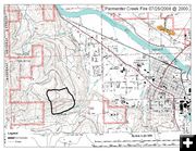
Map of fire, as of Saturday, July 26. Kootenai National Forest graphic.
|

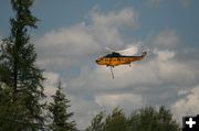
Getting Water
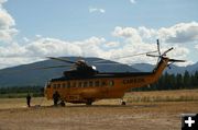
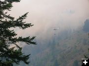
A helicopter prepares to get a bucket of water from the Kootenai River. Photo by Maggie Craig, LibbyMT.com.
|

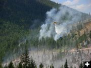
Water Drop
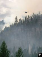
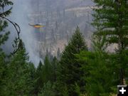
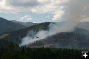
Dropping water on the fire on Sunday afternoon. Photo by Bob Hosea.
|

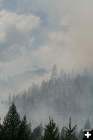
2 Smokey Helicopters
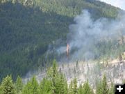
Two helicopters work through the smoke of the Parmenter Fire on Sunday afternoon. Photo by Maggie Craig, LibbyMT.com
|

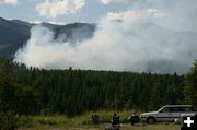
Watching the fire
Residents of Cabinet Heights area watch the fire on Sunday afternoon. Photo by Maggie Craig, LibbyMT.com
|
|
Parmenter Fire updates
Fire at 150 acres, located about ½ mile from Libby; No evacuations at this time
by Dawn Ballou, LibbyMT.com
July 27, 2008 | Updated July 31, 2008
Update Thursday, July 31, 2008, 7:50 AM: We've added more photos of the fire from Saturday and Sunday, courtesy the Augustine family. Scroll down the page to see these new photos. Special thank you to Duane Williams, Bob Hosea, the Augustine family, and Maggie Craig for sharing their photos of the fire!
__________________________
Update Sunday, July 27, 2008, 11:30 PM: We've added more photos of the fire from Saturday and Sunday. Photos by Bob Hosea, Maggie Craig, and Kootenai National Forest.
__________________________
Update Sunday, July 27, 2008 1:00 PM - Kootenai National Forest media release, photos and fire location map:
Information Contact: 406-283-7675
Printable Media Release: Sunday, July 27, 2008, 1:00 pm (PDF)
LOCATION: One-half mile southwest of Libby, Montana
START DATE: July 26, 2008
SIZE: Estimated 150 acres
CAUSE: Under Investigation
CONTAINMENT: 0%
RESOURCES:
Helicopters: 1
Aircraft: 1
Engines: 1
Hand Crews: 3
Dozers: 4
Water Tenders: 4
Personnel: 77
FUELS: Recent logging slash and open timber.
WEATHER:
Temperature: Maximum 85 to 90 degrees
Humidity: Minimum 19 to 29 %.
Winds: Out of the Southwest at 10 to 20 mph.
CLOSURES: The Hemp Hill road (#8837) is closed to public use to ensure their and fire firefighter safety. Lincoln County Sheriff’s Office is providing security at the road closure point.
YESTERDAY'S ACTIVITY: The Parmenter fire was reported around 2:30 p.m. by the fire lookout stationed on Swede Mountain. The fire exhibited active torching fire behavior in areas of heavy timber. It grew from the approximate 7 acre initial size to the current estimate of 150 acres. One small spot fire was located down the hill from road 8837 in an area considered outside planned containment lines. The firefighters at the scene quickly attacked that small spot fire. Dozer and hand lines were constructed on a portion of the fire perimeter. Large and small air tankers dropped fire retardant and helicopters unloaded water by the buckets full. The initial attack forces remained on the fire through the night. A Kootenai National Forest Type 3 incident management team assumed command of the fire from the initial attack crew at 10:00 p.m. last night.
TODAY'S ACTIONS: Fire crews will be completing hand line along the southeast side of the fire. They are also constructing hand line to connect the southwest side of the fire going north from the Parmenter Creek trail to the dozer line constructed yesterday. Fire fighters will be holding the east side of fire as a priority to prevent movement toward the town of Libby. Mopup will start along completed dozer lines. A Type 2 interagency incident management team is on order.
OTHER INFORMATION: Yesterday the Lincoln County Sherriff’s office notified Libby residents in the areas closest to the fire that they may want to start preparation should a decision be made to ask for an evacuation. An evacuation order was not issued.
__________________________
Update Sunday, July 27, 12:50 PM, LibbyMT.com:
Name of fire: Parmenter Fire
Fire size: Estimated at 150 acres
Location: ½ air mile from southwest edge of Libby on the Kootenai National Forest
Resources on fire: Total 57 personnel on this fire. Equipment: 1 Helicopter, 1 Engine, 2 Handcrews, 2 Dozers, 2 Skidgens, 4 Water tenders
Evacuations: NO evacuations or structures threatened at this time
Closures: Hemp Hill Road #8837 is currently closed for public and firefighter safety. Lincoln County Sheriff’s Office is assisting with the road closure.
Cause: Under investigation. Fire appears to have started in logging slash.
Management: Local Kootenai National Forest Type III Incident Management Team under the command of Steve Teigen, with Grant Rider as trainee.
Fire Danger: Very High, no restrictions currently in effect as of the time of this report
Kootenai National Forest Public Information Officer for this fire: Wayne Johnson, 406-283-7675
Comments: Yesterday, residents in the path of the fire were advised by local law enforcement to prepare in case an evacuation is ordered. As of the time of this report, NO evacuations have been ordered. Fire behavior yesterday included some crowning behavior. Fire behavior today may become active as the day progresses. Winds are out of the southwest.
More information about this fire on the web: http://www.inciweb.org/incident/1437/ (This website gets a lot of visitation and is sometimes up and down, so if it doesn't come in, check back a little bit later.)
|


