
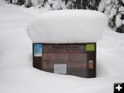
Flower Creek Snow
The Flower Creek Cross-Country ski trail has a lot of snow this winter! Photo courtesy Susie Rice.
|
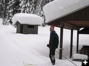
Lots of snow
Dr. Greg Rice of Libby gets ready to ski on the Flower Creek Nordic ski trails. Photo courtesy Susie Rice.
|
|
Winter Storm Watch Tuesday through Wednesday morning
Valleys and mountains in for more snow
February 3, 2008
The National Weather Service in Missoula is advising of a Winter Storm Watch in effect for the Kootenai/Cabinet and Lower Clark Fork regions for Tuesday through Wednesday morning.
A pair of weather systems will be impacting parts of the northern Rockies during the next couple of days. First, a low pressure system tracking through southern Idaho will be bringing moderate amounts of snowfall to north central Idaho and portions of west central Montana tonight. A second Pacific system will be spreading snow into northwest Montana and the Idaho panhandle late Tuesday through Wednesday morning.
Steady snow is expected to develop across northwest Montana Tuesday afternoon as yet another Pacific system approaches from the west. Snow may become heavy at times Tuesday night with the passage of this system. There is a potential for moderate to heavy snow accumulations to occur not only in the mountains, but valleys could also be impacted.
A winter storm watch means there is a potential for significant snow, sleet or ice accumulations that may impact travel.
Editor�s Note: Turner Ski area reports 75 inches of snow at the summit and 60 inches at the base, as of Sunday, February 3. www.skiturner.com
Weather Forecast:
Sunday night: A 20 percent chance of snow showers before 11pm. Cloudy, with a steady temperature around 19. Northeast wind between 3 and 6 mph.
Monday: A 30 percent chance of snow showers, mainly before 11am. Cloudy, with a high near 26. Calm wind becoming west between 5 and 8 mph. Little or no snow accumulation expected.
Monday Night: A 30 percent chance of snow. Cloudy, with a steady temperature around 15. West southwest wind between 4 and 7 mph becoming calm. New snow accumulation of less than a half inch possible.
Tuesday: Periods of snow, mainly after 11am. High near 25. Southwest wind between 5 and 13 mph. Chance of precipitation is 80%.
Tuesday Night: Periods of snow showers, mainly before 11pm. Low around 18. West southwest wind between 13 and 15 mph, with gusts as high as 18 mph. Chance of precipitation is 90%.
Wednesday: Snow showers likely. Mostly cloudy, with a high near 31. Chance of precipitation is 60%.
Wednesday Night: Snow showers likely. Cloudy, with a low around 20. Chance of precipitation is 60%.
Thursday: A chance of snow showers. Cloudy, with a high near 28.
Thursday Night: Snow showers likely. Cloudy, with a low around 23.
Friday: A chance of snow showers. Cloudy, with a high near 32.
Friday Night: A chance of snow showers. Mostly cloudy, with a low around 21.
Saturday: A chance of snow showers. Mostly cloudy, with a high near 31.
Saturday Night: A chance of snow showers. Mostly cloudy, with a low around 22.
Sunday: A chance of snow showers. Mostly cloudy, with a high near 30.
________________________________
Photos courtesy Susie and Greg Rice.
|