NATIVE AMERICANS
Native Americans who lived in this area
before the white man came were mostly members of the Kootenai tribe who
lived
and hunted in this part of Montana and adjoining territory in Idaho and
Canada. While it is believed that no tribe made a permanent home in the
Libby area, several tribes frequented the area to hunt and for spiritual
purposes. The Kootenai Indians were from the west, and the Blackfeet Indians
were from the eastern side of Montana and the Continental Divide. At times,
when the tribes met, they fought in order to steal goods and horses, or
to settle old scores resulting in tribe members on both sides being killed.
Kootenai Falls on the Kootenai River is
still a sacred site to the local Indians, a place where tribal members
commune with spiritual forces.
The Libby area
held another special attraction for Indians of all tribes. A certain location
up Pipe Creek contained soft, multicolored stone which they used in carving
the bowls for their tobacco pipes, which they smoked in ceremonies. The
Pipe Creek quarry was regarded as the best quarry in the Kootenai territory,
containing stones of several different colors including red, yellow, black,
green, gray or banded, which is how Pipe Creek got its name. The 1 foot
long pipe stems were made from any wood that had a pithy core that was
easy to drill or remove such as willow, quaking aspen and chokecherry.
A native plant that served as tobacco was cultivated by the early Kootenai,
but later they switched to tobacco which they traded with white men who
came to the area in the 1830s.
The Kootenai's were composed
of three bands, a Tobacco Plains band in the Upper Kootenai, Mid-Kootenai
who frequented the Libby and Jennings area, and Lower Kootenai's who lived
near Bonner's Ferry, Idaho. The Libby area Kootenai were canoe Indians,
often using the river for transportation. They were noted for their plain
clothing, absent of decoration, with long fringes. The tribes subsisted
on bison, deer and elk as well as berries including chokecherry, serviceberry
and huckleberry. In 1855, the Kootenai's were relocated south
of Flathead Lake with the Salish Indians on the Flathead Reservation, where
many still live today.
EARLY EXPLORERS AND FUR TRADERS
In the early 1800s, David Thompson, a
Canadian explorer and employee of the
Northwest Company, traveled into the Kootenai
River area and used the Kootenai as a navigational guide through the area
following Native American Indian and game trails. He portaged around the
falls, following piles of rocks, known as cairns, which
marked the trail, left by the Kootenai
Indians. The first
white men in the area were trappers and traders from British fur companies.
They came as early as 1809 searching for beaver to supply the demand back
east for beaver fur hats.
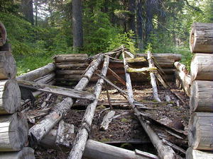
There were
several forts, or posts, built by early traders along the Kootenai River
which were small log huts or tents, which served the general trading purpose.
These were temporary structures that were frequently moved, and none of
these remain today. A warehouse fort was built above Kootenai Falls in
the winter of 1808-1809 by Finan McDonald. This was noted by explorer David
Thompson in May, 1809, and may have been near Rainy Creek. Two other forts
were built near Rainy Creek in 1812 and 1824. Another fort was built by
Hudson's Bay Company men in the winter of 1810-1811, on the north side
of the Kootenai River one mile downstream of the old town site of Jennings,
Montana. Other forts or posts were built by the Northwest Company and the
Hudson's Bay Company in the area until 1860.
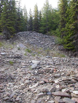
 MINING MINING
The Libby area was important for both
its long-lived placer operations and several of its silver-lead mines.
The only gold-quartz vein of any significance is found in the Prospect
Creek area. Silver-lead-zinc veins are found primarily along the Snowshoe
fault in the Cabinet Wilderness area, and are still mined today. The source
of placer gold in the Libby Creek area has never been exactly determined,
but is thought to come from veins eroded into both Libby and Howard Creeks.
Prospectors first tested
the gravels of the Libby district in the early 1860s. John S. Fisher and
several other men came through the area at that time looking for gold.
They also named a number of the local creeks including Fisher River, Libby
Creek (after Stephen Allen's daughter Elizabeth or Libby), and Sherry Creek
(after Jack Sherry), later changed to Cherry Creek. Activity increased
during the summer of 1867 when a group of prospectors started placering
along Libby Creek. Their success attracted as many as 500-600 men to the
camp by September. Fortunes varied, however, with some making as much as
$1.25 per pan while others washed only two cents per pan. Most men left
for the winter, and those who stayed helped dig a ditch to bring water
to some claims. While the camp increased again the following summer, the
boom was brief and it was virtually deserted by the 1870s.
Chinese workers played
an important role in the early placer mining on Libby Creek. In one
incident, several Chinese workers were caught robbing sluice boxes of gold
dust, and were driven out of the country. They lingered awhile at the rapids
of the Kootenai, above the falls, to try their luck at washing gold, which
is how China Rapids got its name.
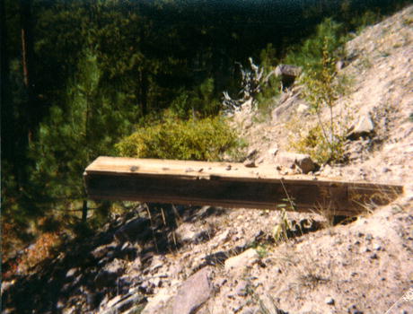
Snowshoe Mine - Lead/Silver/Gold
The Snowshoe lode was discovered
in October, 1889, while two miners were prospecting up Leigh Creek near
Libby. The rich ore deposit at the Snowshoe encouraged operators to develop
the mine. In the late 1890s, the ore was milled at the mine and then shipped
to a smelter at Great Falls. By the end of the decade, the mine was electrified,
a telephone line linked it to Libby, and a compressor supplied power to
the crews. Although a good wagon road connected the mine to the Great Northern
Railroad at Libby by the early 1900s, the 20 mile trip was accomplished
with horse teams and wagons up to the time the mine closed. Operators tried
using trucks but found they did not have sufficient power on the hills.
Despite the many problems, the Snowshoe was the most important lode producer
in the Libby area, reporting production every year from 1905-1912. The
total is estimated at 145,000 tons, with smelter returns of $1,211,000
in lead, silver, and gold. Underground workings included two shafts (475
and 550 feet deep) and 11,000 feet of tunnels, drifts, and connecting raises.
A full-scale display of the entrance to the Snowshoe Mine can be seen at
the Heritage Museum in Libby.
The Vermiculite Mine
Vermiculite deposits were first located
by prospectors in the early 1900s on Rainy Creek northeast of Libby.
Ed Alley, a local rancher, was also a prospector and explored the old gold
mining tunnels and digs in the area. While exploring the old tunnels in
the large mountain north of Libby he stuck his miner's candle into the
wall to chip away some ore samples. When he got his candle, he noticed
that the material around the candle had swollen and turned golden in color.
He had discovered a unique mineral that expanded when heated. In
1919, E.N. Alley bought the Rainy Creek claims and started the Zonolite
Company. While others thought the material was useless, he experimented
with it and discovered it had good insulating qualities. Through his marketing
skills, it became a product used in insulation, plaster, and to lighten
garden soil. Many people used vermiculite products for insulation in their
houses in Libby and in their gardens.
The W. R. Grace Company bought
the mine and operated it from 1963 until its closure in 1990. They then
sold the property to Kootenai Development Co. While in operation, the vermiculite
mine in Libby may have produced 80% of the world's supply of vermiculite
and was a significant employer of many Libby townspeople.
In late 1999,
the mine was blamed for dozens of asbestos-related deaths and illnesses
among Libby residents and former employees due to exposure to asbestos-tainted
vermiculite. The Environmental Protection Agency has been working legally
to intervene and remove asbestos-contaminated soil from the screening plant,
and to dispose of that soil and continue cleanup operations at the former
mine site just down the road. The EPA has conducted numerous air, soil,
dust and insulation samples to determine levels of asbestos that may still
be in the community and any health hazards to people who currently live
here and have little to no connection to the old vermiculite mine. Preliminary
test results in Libby, conducted by the U.S. Agency for Toxic Substances
and Disease Registry, showed lung abnormalities in higher percentages than
expected for people who didn't work at the mine and had no known exposure
to the vermiculite dust. The health concern is for asbestosis, a restrictive
lung disease which can be fatal, and is caused by exposure to asbestos.
The disease can cause lung cancer and a cancer of the lung lining called
mesothelioma. The EPA is most concerned about people being exposed to airborne
asbestos and breathing the tiny asbestos fibers. This is a serious health
issue that the town still faces today and has impacted recent tourism and
the town's economy.
 EARLY
SETTLERS EARLY
SETTLERS
The earliest ranches in the area were
located near the mouth of Libby Creek in the late 1880s in the hopes of
taking advantage of the rumored coming of the Great Northern railroad to
the coast. The early settlers worked at the nearby Libby Placers and built
homesteads and mills along Libby and Flower Creeks. The stream, "Libby
Creek" was named by prospectors in the 1860s after one of their daughters,
and it is believed that the town of Libby was named after this creek.
The first wagon roads in
the area were built in the 1880s-1890s, and were nothing better than ungraded
trails that accessed homesteads or mines. The first real wagon roads, called
"tote roads" were roughly cut openings for construction camp supplies to
be brought through.
In the early days, crossing
the Kootenai River was a hazardous endeavor, and usually done using horses.
Later, ferries were built across the river, with the first toll ferry built
in 1892. In 1912, the citizens of newly-formed Lincoln County voted
in bonds for the construction of roads and bridges, resulting in three
steel and concrete bridges being built across the river, one at Libby,
one at Troy, and one at Rexford. The first automobile came to Libby via
road from Kalispell in 1913.
The Northern Pacific Railroad
was the determining factor of the location of the townsite for present-day
Libby. In 1890, the railroad made the preliminary surveys for its path
and negotiations for rights-of-way were made, determining the location
of the town. The early speculators surveyed and plotted 40 acres into city
lots and hired men to clear the timber so that streets and buildings could
be built. All of the inhabitants of Libby "Old Town" moved over to the
more convenient location. The first train, hauling passengers and freight,
arrived in Libby on May 3, 1892. The railroad was a significant factor
in changing the course for Libby and settling of the west, allowing the
easy, economical access that was needed for many more people to come to
the area to live and work.
Libby is spread out into
two areas because the original speculators did not realize that the land
they had begun to sell and build on near the confluence of Libby Creek
and the Kootenai River had actually been a section originally conveyed
to the railroad as part of a land grant giving them uneven numbered sections
some years earlier. A homesteader who owned land approximately one mile
south of Libby plotted forty acres of his homestead into fifty foot lots
and called it South Libby. Settlers who could not get clear title to their
land on the northern townsite, eagerly bought building places there. The
two towns were separated by heavy timber about one-half mile wide for many
years. The railroad later sold the title to the land to the Townsite Company,
which was then able to issue deeds to the lots.
The town grew quickly in
the early 1900s, with many new businesses opening. The first cement sidewalks
were built, streets were graded, and electric lights and water systems
installed. In 1906, a disastrous fire swept through downtown Libby, destroying
many of the original business buildings.
The first school house was
built in 1892, a small board building, in the same block as Libby Hotel.
The first church was the old log Methodist Church in 1897. The first homes
were built in the early 1890s with dirt floors and dirt roofs. The first
newspaper was the Libby Miner in 1892. Telephone service came to
Libby and Troy around 1913.
Jennings
Not much is left today of the town of
Jennings, located near the confluence of the Kootenai River and Fisher
River upstream from Libby. It looks like just a grassy meadow flat dotted
with cottonwood trees along the Kootenai River next to the railroad tracks.
But at the turn of the century it became a bustling railroad town, with
a railroad station, two general stores, a section house and roundhouse,
restaurants, saloons, a boarding house, customs office, schoolhouse with
a cemetery, homes and boat docks.
The Great Northern railroad
reached the townsite of Jennings in 1891 opening options for both railroad
transportation and river traffic, allowing trade with settlers of Tobacco
Plains and Fort Steele, British Columbia. Enterprising businessmen took
advantage of the Jennings river site to construct a steamboat venture business,
with the first steamboat, the "Steamer Annerly", launched in 1892 to carry
freight and passengers the 150 miles upriver to Fort Steele. Over the next
10 years, several steamers and paddlewheel boats were built at or near
Libby and used to transport freight and mining ore to other towns and smelters.
These ships had names including "Fool Hen", the "Steamer Libby", the "Steamer
Ruth", the "Rustler", and the "North Star". The last steamer built for
navigation of the Kootenai was completed in 1898.
The town of Jennings thrived
on the river and railroad traffic at the turn of the century and it was
estimated in some accounts that as many as 5,000 men a day passed through
the town of Jennings on their way up the Kootenai River to the railroad
camps. The town suffered from two fires ten years apart, in 1904 and 1914,
which destroyed the hotel, store, train depot and all the buildings on
the east side of the town. By the early 1930s, the town had almost died
and the only building left was the school house. It was torn down in the
early 1970s when the reregulating dam was proposed for the main Libby Dam
just upstream. Foundations for a few of the buildings from the town of
Jennings can still be seen today, and a couple of apple trees, enjoyed
now only by the nearby wildlife, still grow there.
TIMBER INDUSTRY
The first saw mill was built by the first
townsite company in the winter of 1891-1892 near the present day bridge
across the Kootenai River and was used to supply lumber to build the growing
town. Other sawmills were built in the late 1800s and early 1900s, with
most lumber used locally.
In 1906 the Dawson
Lumber Company built a modern sawmill plant bringing workers and their
families to the town in greater number. Many built homes and decided to
make Libby their permanent home. In 1911, J. Neils and Associates bought
the Dawson Lumber Mill and it was later named the Libby Lumber Company.
Familiar with the timber industry, the owners believed that reforestation
was a necessary part of the industry, and they implemented an active tree-planting
program through the company. The J. Neils Lumber Company grew and the town
prospered as well, with as many as 1,000 people employed in Libby in the
early 1900s. Lumber company railroad tracks were built and brought the
logs to the mill. The original tracks ran from the lumber mill south along
Libby Creek and eventually up Swamp Creek. Railroad logging along some
14 miles of main track was conducted from 1906 to 1925 along the south
side of the Kootenai River into the Libby Creek drainage. By the mid 1930s,
railroad logging was phased out and replaced by trucks.
The Fire of 1910
The summer of 1910 was unusually dry with
fires beginning as early as June that year. Steady heat through July and
August caused the forest to become extremely tinder dry. At that time,
the Forest Service was still in its infancy, and did not have the manpower
to staff the Forests. Available crews were already battling many small
blazes in Idaho and western Montana during the summer. Firefighters had
to use pack trains to bring in crews and equipment. No major roads were
yet in place, and the terrain was forested and steep. In August, strong
southwest winds flamed the many small fires and turned them into raging
infernos, merging small blazes into larger ones that swept through the
country with unbelievable speed. Calls for help were relayed by telegraph
and thousands of firefighters, homesteaders and miners fled the area for
their lives to the safety of Missoula or Spokane, Washington. The fire
burned a path 30-50 miles wide, with over 100 square miles of timber burned
in Montana. The town of Sylvanite was burned to the ground. The fire came
as close as three miles to the town of Troy and over 200 people manned
firelines to keep the fire from consuming Libby. Within 48 hours, most
of the damage was done from the blaze. Blackened tree stumps can still
be seen in areas of the Kootenai Forest today as reminders of the 1910
fire. As a result of the devastation of that summer's fires, Congress authorized
the first national fire protection system for the nation's forests in 1911.
For More Information:
Local Area History Books:
Published by the Libby Pioneer
Society and the Libby Woman's Club:
Nuggets to Timber,
Pioneer Days at Libby, Montana; 1970
Published by the Libby Montana
Institute of the Arts Writers Group, Inc, Libby, Montana:
Times We Remember
In the Shadows of
the Cabinets
The Shining Tree
Echoes Along the
Kootenai
Pages From The Past,
1989
Tapestries Of Yesterday;
1993
The above books are available
from the Heritage Museum and
local bookstores.
More about Libby area mines
and mining:
http://www.deq.state.mt.us/rem/mwc/linkdocs/techdocs/108tech.html
http://www.epa.gov/region8/superfund/libby/lbybkgd.html
http://www.atsdr.cdc.gov/NEWS/libbymt2.html
Other History:
Natural
Resource Information System/Montana |